

- Date
- 5 ຕຸລາ 2026
This post is also available in: 简体中文 (ພາສາຈີນ) English (ພາສາອັງກິດ) 日本語 (ພາສາຍີປຸ່ນ) 한국어 (ພາສາເກົາຫລີ) ไทย (ພາສາໄທ) Topographic Survey & UAV LiDAR Data Acquisition LaoEarth conducted a […]- Date
- 24 ສິງຫາ 2026
This post is also available in: 简体中文 (ພາສາຈີນ) English (ພາສາອັງກິດ) 日本語 (ພາສາຍີປຸ່ນ) 한국어 (ພາສາເກົາຫລີ) ไทย (ພາສາໄທ) Some of our recent activities for GNSS Survey Work Static […]- Date
- 24 ສິງຫາ 2026
This post is also available in: 简体中文 (ພາສາຈີນ) English (ພາສາອັງກິດ) 日本語 (ພາສາຍີປຸ່ນ) 한국어 (ພາສາເກົາຫລີ) ไทย (ພາສາໄທ) River Cross-Section & Longitudinal Profile Survey Bathymetric & River Profile […]
This post is also available in:
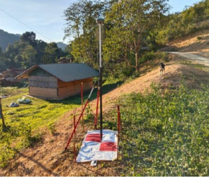
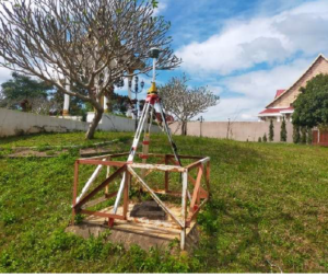
Some of our recent activities for GNSS Survey Work
Static Survey Mode:
- Observation method: Static method.
- Observation time: 2h at least.
- Interval of data acquisition: 15 seconds.
- Satellites received status: 5 up (more than 5 satellites)
- Horizontal: ± 05mm + 5ppm base line.
- Vertical: ± 10mm + 10ppm base line.
- Elevation Mask: Equal or greater than 15 degrees.
- RTK Survey:
Field technique: Real- time Kinematic L1/L2 - Hardware required: L1/L2 Receiver. L1/L2 Antenna
- Time of Occupation: 3-5 Seconds per occupation
- Baseline Precision: 1cm+2ppm x Baseline Length
(horizontal)\ - 2cm+2ppm x Baseline Length (vertical)
- Advantages: Very short occupations, extremely efficient data
- collection, initialization done in the field (after lock is lost, reinitialization
- takes place automatically while moving-called OTF), can perform staking
- Disadvantages: For short baselines only (+/- 10 km)
-