

- Date
- 5 ຕຸລາ 2026
This post is also available in: 简体中文 (ພາສາຈີນ) English (ພາສາອັງກິດ) 日本語 (ພາສາຍີປຸ່ນ) 한국어 (ພາສາເກົາຫລີ) ไทย (ພາສາໄທ) Topographic Survey & UAV LiDAR Data Acquisition LaoEarth conducted a […]- Date
- 24 ສິງຫາ 2026
This post is also available in: 简体中文 (ພາສາຈີນ) English (ພາສາອັງກິດ) 日本語 (ພາສາຍີປຸ່ນ) 한국어 (ພາສາເກົາຫລີ) ไทย (ພາສາໄທ) Some of our recent activities for GNSS Survey Work Static […]- Date
- 24 ສິງຫາ 2026
This post is also available in: 简体中文 (ພາສາຈີນ) English (ພາສາອັງກິດ) 日本語 (ພາສາຍີປຸ່ນ) 한국어 (ພາສາເກົາຫລີ) ไทย (ພາສາໄທ) River Cross-Section & Longitudinal Profile Survey Bathymetric & River Profile […]
This post is also available in:
River Cross-Section & Longitudinal Profile Survey
Bathymetric & River Profile Survey
LaoEarth conducts professional river cross-section, longitudinal profile and bathymetric surveys to accurately measure river geometry, water depth and bed elevations.
The survey combines CHCNAV GNSS RTK positioning, echo-sounder technology, hydrographic survey software and elevation control to produce accurate digital profiles of river channels and underwater terrain.
These surveys provide essential data for bridge and infrastructure design, hydraulic modelling, flood studies, river management, dredging, erosion assessment and water-resource development.
Survey Methodology
River cross-sections are established at predetermined intervals, typically approximately 5–10 metres apart, depending on the project requirements, river geometry and survey objectives.
Each cross-section is surveyed systematically from one riverbank to the other to capture:
- Riverbank positions
- Water-surface elevation
- River-bed elevation
- Water depth
- Channel width
- Cross-sectional geometry
- Longitudinal river profile
GNSS RTK Positioning & Survey Control
CHCNAV GNSS RTK equipment is used to establish accurate horizontal positioning for the survey.
A GNSS reference station is installed at a suitable known or established control point onshore, where the surrounding environment provides clear satellite visibility and reliable communication with the survey rover.
The GNSS rover is installed on the survey boat and provides real-time positioning during the bathymetric survey.
The reference and rover receivers simultaneously observe common GNSS satellite signals. Differential correction information is transmitted from the reference station to the rover through the data link, allowing the position of the survey boat and each sounding point to be determined accurately in real time.
Bathymetric Depth Measurement
Water depths are measured using a CHCNAV Echo Sounder D390.
The echo sounder transducer and GNSS rover antenna are positioned with a known and consistent horizontal relationship, allowing the measured water depth to be accurately associated with the corresponding geographic coordinate.
The echo sounder continuously records depth measurements and transfers the data electronically to the onboard survey computer for processing and integration with the GNSS positioning data.
This produces a synchronized dataset containing:
Easting + Northing + Water Depth + Water-Surface Elevation
which can subsequently be used to calculate the elevation of the riverbed.
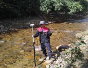
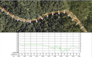
Our recent survey on River Cross Section and Profile Survey
Hydrographic Data Collection
Survey data collection and recording are performed using a laptop computer with hydrographic survey software.
Before the survey begins, the required cross-section lines and measurement-point spacing are established within the survey software.
The survey boat then navigates along each predefined cross-section while the system simultaneously records:
- GNSS coordinates
- Water depth
- Survey time
- Cross-section position
- Water-surface information
This integrated workflow allows the survey team to efficiently capture and organize large volumes of river survey data in digital format.
Riverbed Elevation & Vertical Control
Riverbed elevations are calculated by combining the measured water-surface elevation with the corresponding water depth.
Where required, water levels at the relevant hydrometric station and/or water-level observation points are recorded concurrently with the bathymetric survey. These observations provide an important reference for checking and validating the water-surface elevation during the survey period.
Vertical elevations are established using appropriate levelling and/or GNSS-based elevation control methods, depending on project requirements.
The resulting data allows the elevation of individual underwater survey points to be determined and used to generate accurate river cross-sections and longitudinal profiles.
Key Deliverables
Depending on project requirements, LaoEarth can produce:
- River cross-section drawings
- Longitudinal river profiles
- Bathymetric survey maps
- Riverbed elevation data
- Digital terrain models of river channels
- Water-depth maps
- Cross-section coordinate tables
- Survey point databases
- CAD drawings
- GIS-compatible datasets
- 3D river-channel models
Applications
River cross-section and bathymetric surveys are particularly useful for:
Bridge & Road Design • Hydropower Projects • Flood Risk Assessment • Hydraulic Modelling • River Management • Dredging & Sedimentation Studies • Erosion Monitoring • Irrigation & Water Resources • Infrastructure Development
Integrated Survey Workflow
GNSS Control → RTK Positioning → Survey Boat Navigation → Echo-Sounder Depth Measurement → Hydrographic Data Collection → Water-Level Observation → Data Processing → River Cross-Sections & Longitudinal Profiles